Posts

Showing posts with the label GEOGRAPHY

30+ Interesting Facts About Mount Everest

Image
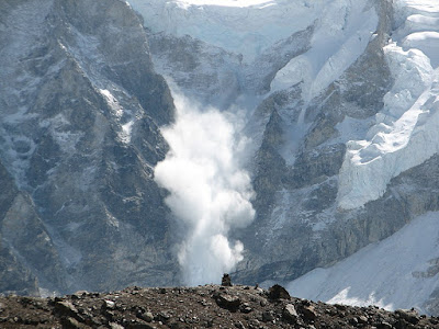
Mount Everest is a mountain in the Great Himalayas. This tall mountain in southern Asia is on the border between Nepal and Tibet , an autonomous region of China. Mount Everest is the highest mountain above sea level , having an altitude of 8,848 m (29,029 ft.). However, the tallest mountain on Earth is Mauna Kea in Hawaii. Its summit is 10,210 m (33,500 ft.) high, but its large portion is beneath the Pacific Ocean. The highest point above Earth’s center is the peak of Mount Chimborazo in Ecuador . It is due to this mountain’s location where the Earth’s bulge is the greatest. ( Source ) Mount Everest was recognized as the highest point on the surface of Earth in 1852. Its initial name was Peak XV, but was later renamed in 1865 to honor Sir George Everest, who remained the surveyor general of India from 1930-43. There are other names for this mountain in local languages: Nepalese and Tibetan. There are a total of 17 routes to climb Mount Everest. However, the main routes are Southea...

20 Interesting Facts About the Nile River

Image
The Nile, a river in northeastern Africa, is the world’s longest river. It flows from south to north and drains into the Mediterranean Sea. The Nile, with a total length of 6,695 km (4,160 miles), is the  longest river  in the world. Its primary source is Lake Victoria, while the farthest point is a stream in Burundi. On the other hand, the disputed maximum length of the Amazon River is 6,750 km (4,195 miles). However, its ending point is uncertain, which makes it the second-longest river. ( Source ) Despite being the longest river, the Nile has less discharge than many other rivers . The largest river by discharge is the Amazon River (nearly 209,000 cubic meters per second). Comparatively, the discharge of the Nile River is only 2,830 cubic meters per second. The Nile River basin covers nearly 10% of Africa in several countries. These include Egypt, Sudan, South Sudan, Eritrea, Ethiopia,  Kenya , DR Congo, Burundi, Rwanda, Uganda , and Tanzania . The Nile has two pri...

20 Interesting Facts About the Arctic Ocean

Image
The Arctic Ocean is the northernmost of the five oceans , while the North Pole lies in the middle of this ocean. Six countries (Russia, Norway, Iceland, Greenland (Denmark), Canada, and the USA) of three continents ( Asia , Europe, and North America) surround the Arctic Ocean. Sea ice in the Arctic Ocean grows and shrinks during winter and summer. The ice reaches its maximum extent in March and shrinks to its minimum level in September annually. Warmer temperatures are responsible for the rapid shrinking of the Arctic ice. Satellite observations have measured Arctic ice each year since 1979. The summer Arctic ice is now shrinking at 12.2% per decade compared to its average shrinking from 1980 to 2010. Scientists measured the lowest summer Arctic extent (3.39 million square km) in September 2012. ( Source ) Storms in the Arctic Ocean usually occur in the winter. However, an extraordinary storm during the summer (August) of 2012 detached a large amount of ice from the ocean. The 2012 Ar...

15+ Interesting Facts About the Kalahari Desert

Image
The Kalahari is an arid to semi-arid flat area in southern Africa. It covers most of Botswana and parts of Namibia and South Africa . A vast area of the Kalahari Desert is composed of reddish sand due to a thin layer of iron oxide. The soil is alkaline, very dry, and low in organic material. There are various pans in the desert where the soils are extremely saline, making them toxic to most plant life. Okavango River flows from Angola and drains into the Kalahari Desert, where it forms the Okavango Swamp , an inland delta. It is one of a few inland delta systems without an outlet to the sea, making it the largest endorheic delta in Africa . This delta is responsible for the diversity of wildlife in the Kalahari Desert. Different areas in the Kalahari support  diverse  plant  life  according to their precipitation level. The southwestern part is the driest region and generally contains short grasses and drought-tolerant shrubs. There are shrubs, grasses, and scattere...

15+ Interesting facts About the Namib Desert

Image
The Namib is a cold coastal desert along the Atlantic Ocean in southwestern Africa. Its major portion is in Namibia, while small parts are in Angola and South Africa . The Namib is the only true desert in southern Africa and one of the two major coastal deserts (along the Atacama Desert in South America ) in the world. It has no surface water and receives less than 8 inches of precipitation annually. The Namib is the oldest desert in the world. According to scientific estimates, it formed at least 55 million years ago. The temperature of the Namib Desert remains mild near the coast throughout the year, ranging between 10 and 16 C. In inland areas, the temperature usually remains higher than 30 C during summer. It can also exceed 38 C for some days under the influence of winds blowing from the east. The Namib Sand Sea, the sandy part of the Namib Desert, became a  UNESCO World Heritage site  in 2013. It is famous for having two dune systems and numerous wild  animals ....

15+ Interesting Facts About the Gobi Desert

Image
The Gobi is a cold desert in southern Mongolia and northern China. Its name derives from a Mongolian term meaning “waterless place.” The Gobi is the world’s 5 th largest desert and the 2 nd largest in Asia after the Arabian Desert. Another large desert, the Taklamakan Desert , is located to its west. Gobi Desert contains five eco-regions based on their distinct physical features and climate. These include Gaxun, Junggar, Trans-Altai, Alxa Plateau, and the Eastern Gobi. The Gobi Desert lies between several mountain ranges: Altai Mountains, Khangai Mountains, Tian Shan, Kunlun Mountains, and Altun Mountains. These mountain ranges play a vital role by creating a rain shadow effect over the Gobi. Researchers discovered stone tools from the Middle Paleolithic (Old Stone Age) between 200,000 and 40,000 years ago in 2016. They also found 40,000-year-old jasper artifacts. This area in the southern Gobi Desert once had lakes and wildlife. ( Source )  Scientists have discovered ancient st...

20 Interesting Facts About the Atacama Desert

Image
The Atacama Desert is an arid region in northern Chile. This coastal desert generally lies between the Pacific Ocean and the Andes Mountains. The Atacama Desert is the driest place in the world , having an annual rainfall of 0.03 inches. It is the only true desert that receives less rainfall than polar deserts . Due to its arid atmosphere, scientists consider it a valuable place to find clues about life on other planets. ( Source ) The hyper-arid core of the Atacama Desert did not receive rain for 500 years. After the first recorded rainfall during the 21 st Century, the desert lost nearly 85% of its indigenous microbial species. This event can provide information about the effects of precipitation on Mars and other hyper-arid planets. ( Source ) In 2023, scientists discovered a “dark microbiome” in the Atacama while testing scientific instruments designed for Mars. These microorganisms are either non-existent on other parts of Earth or have lost their relatives in the past. ( Sou...

25 Interesting facts About the Sahara Desert

Image
The Sahara is the largest hot desert and the third largest desert in the world after two polar deserts ( Antarctica and the Arctic). It spans 11 countries of this region. This desert covers almost the entire northern Africa except small areas in the north with a Mediterranean climate. It borders the Mediterranean Sea and the Atlas Mountains in the north, the Red Sea in the East, the Atlantic Ocean in the west, and the Sahel (a semiarid region) in the south. The Sahara Desert is primarily rocks, limestones, and sandstones, while the sand covers only 25% of its surface. Several dunes can reach up to 500 feet, while the height of ergs (sand seas) can be 1000 feet.   The summit of Mount Koussi (11,204 feet) in Chad is the highest point in the Sahara Desert. The lowest point in this desert is the Qattara Depression (436 feet below sea level) in Egypt. According to the latest research, the Sahara Desert formed around  7 million years ago  after the drying of this region b...

20+ Interesting Facts About Rainforests

Image
The main features of rainforests are tall trees, several layers of plants, and abundant rain. They grow in areas with warm and wet climate throughout the year. There are two main types of rainforests: tropical and temperate. Tropical rainforests are generally present in Central and South America, Southeast Asia , and western and central Africa . Temperate forests are usually present in coastal and mountainous areas in western North America, Chile, southern Australia, New Zealand, Japan, Norway , and the UK . Rainforests are the oldest living ecosystem on Earth. Some of these are tens of millions of years old. Rainforests receive the heaviest amount of rainfall among all biomes. Tropical rainforests receive 200-1000 cm (80-400 in.) of rain per year, while temperate rainforests get 150-500 cm (60-200 in.) of rain annually. Temperate forests compensate for less precipitation through dense fog. Daintree Rainforest (180 million years) in Australia , Borneo Lowland Rainforest (140 milli...